This is the last of my three posts about my mid-March 2022 trip to the John Day Fossil Monument National Park in eastern Oregon. Located about 4 hours east of Portland, this unique national park has 3 units, each which very different experiences. I covered some of the logistics of how to get here in my first post, and the second post covered the 2 units of the Clarno Unit with its Palisades and the Sheep Rock Unit with the Blue Basin. This last post is only on visiting the Painted Hills, the most famous unit of the 3 and listed as one of the seven wonders of Oregon.
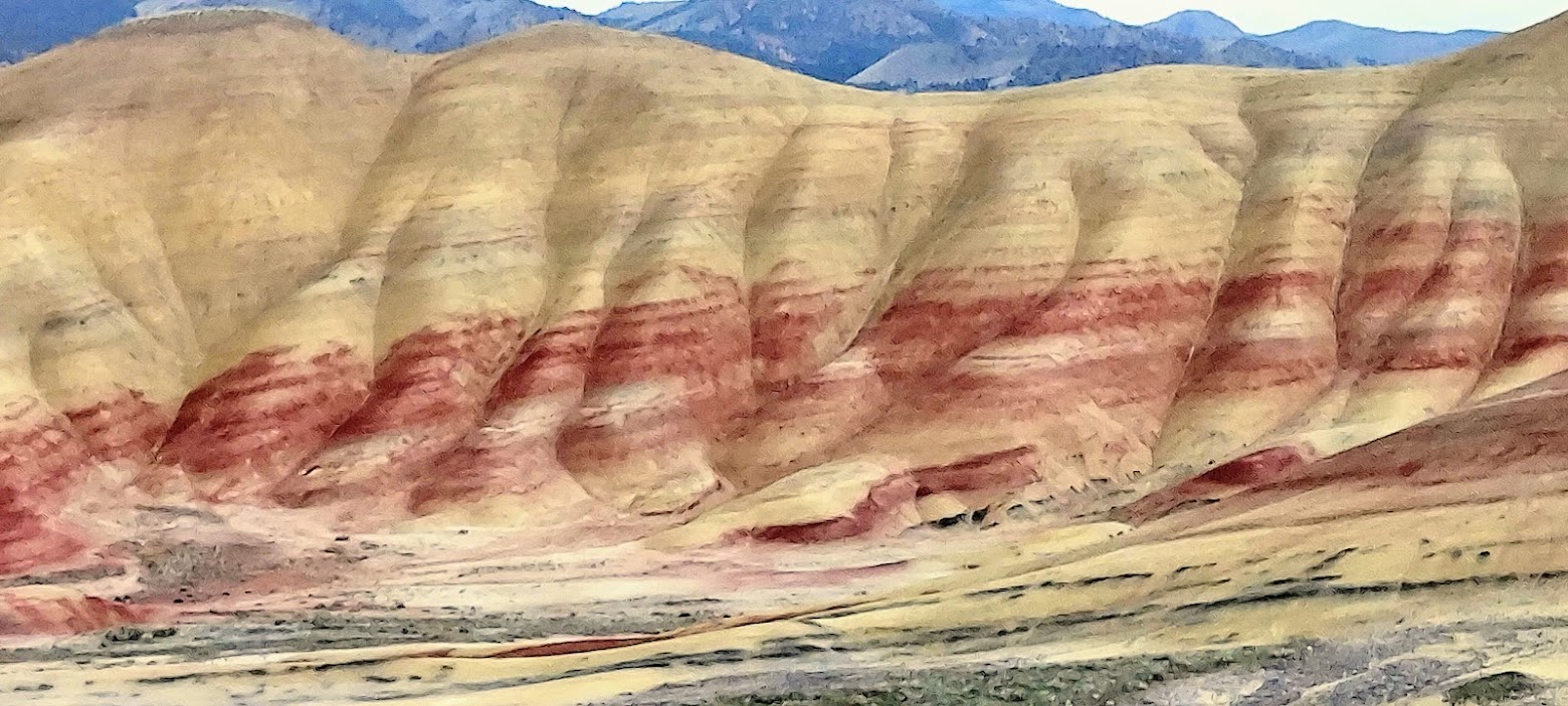
The Painted Hills Unit is located about 9 miles northwest of the town of Mitchell, Oregon, which makes it the closest base to visiting the unit. The stripes of red, tan, orange, yellow, streaks and dashes of black, all are a testament to the geological past representing changes in sediments over this region over 33 millions of years. 

Plan part of your time visiting the Painted Hills as close to a golden hour (the 1-2 hours before sunset or after sunrise) as you can. The lighting between morning and late afternoon are different – I think in particular the early evening light is softer, so makes for great photos. Also, the main view you see at Painted Hills Overlook and Carroll Rim Trail are hills that you look east towards, so the sun will be behind the hills the first part of the day causing camera glare, and the colors of the valley between the hills in shadow at first. If you are visiting the Painted Hills after it rains, that’s a plus – the saturation of the clay soils will make the color of the hills intensify by sealing the surface to reflect light while also expanding the clay, and you will see more of the black manganese deposits streaks.

Spring is a great time of year as the temperatures will be more moderate – during our visit we were around mid 50-70 degrees Fahrenheit. There are five trails available at the Painted Hills – each short, but still carry plenty of water. Some vault toilets are available by a picnic area. There is no entrance fee to enter any of the units of the John Day Fossil National Monument, but note that only the Sheep Rock Unit offers a visitor’s center. When you enter the Painted Hills area, you will be on gravel roads. You may encounter wildlife crossing ranging from deer to cows along the way so drive carefully around the curves as you approach the park.
Most popular trails at Painted Hills
Painted Cove Trail is where you’ll want to head to first to get that iconic photo of the boardwalk and red hills. This is a .25 mile roundtrip loop on a level boardwalk so very accessible. Besides the boardwalk, the whole point of the boardwalk is that it lets you walk very close to the soils to see the different colors up close – otherwise your view of the colors will be from a distance. Needless to stay, stay on the boardwalk and trails as your footprints can damage and leave lasting imprints for years and the soils are very sensitive. You have to drive past the Painted Hills Overlook to reach here, but I prefer visiting Painted Cove as a first stop because it gives you a closeup view before your vista and panoramic views. Sun placement also doesn’t matter as much here.