In my previous post, I provided some of my research in traveling from Portland to Crater Lake National Park by car and some stops along the road trip you could take along Highway 58. In today’s post, I’ll share some stops along the scenic and historic Rim Drive and the views of the different blues you may see depending on your weather conditions. The Rim Drive is 33 miles of road that goes around the whole of Crater Lake, with plenty of pull-outs and parking and 30 overlooks with lake views and vistas to see along the loop. I will cover what we did when there was not enough visibility to view much of Crater Lake, and then the brilliant views at Crater Lake that include the most beautiful blues when we finally got a sunny third day.

Background
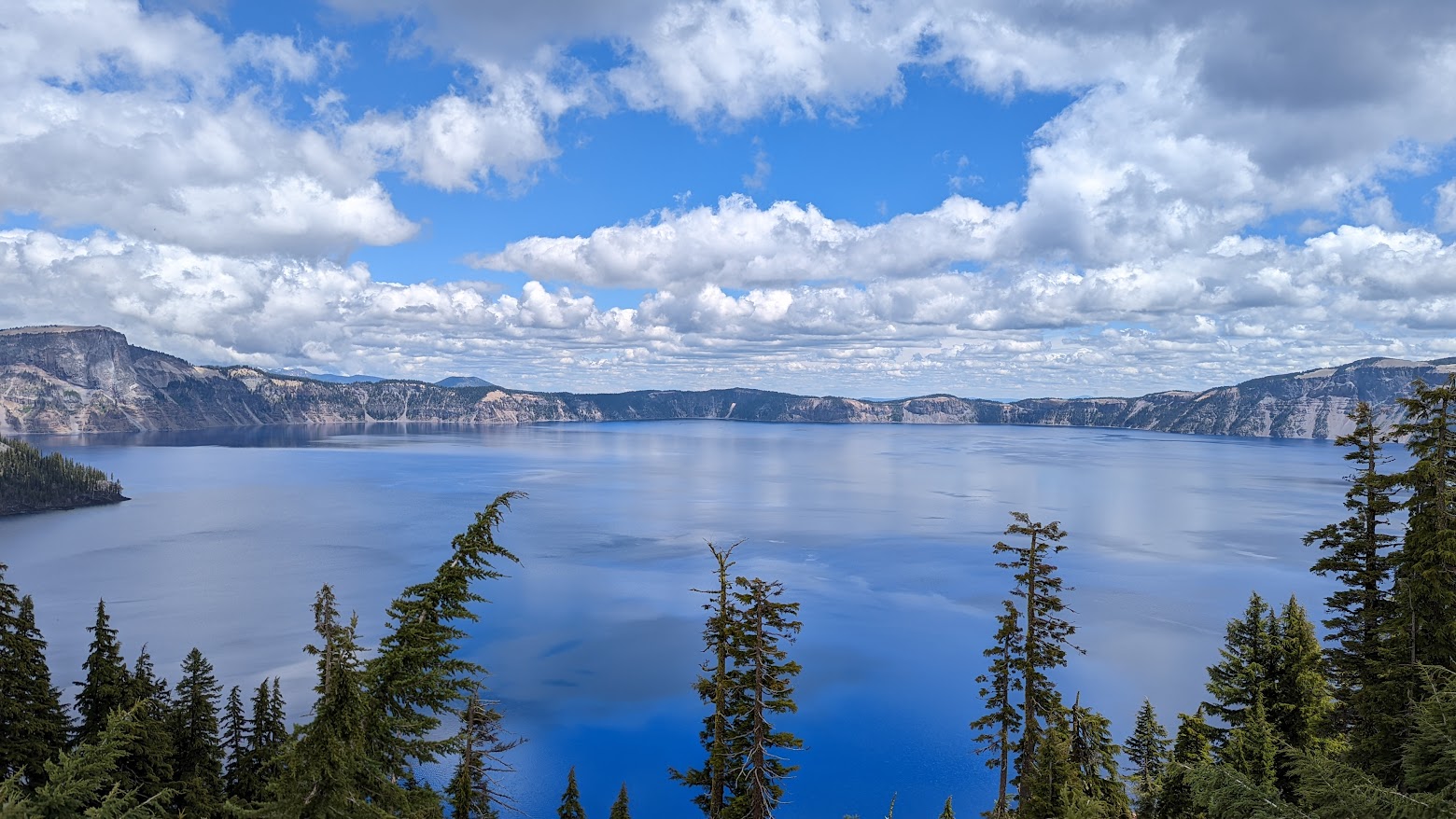
Crater Lake National Parks’ deep blue water and caldera walls have attracted people for thousands of years. Crater Lake formed when 12,000 foot Mount Mazama imploded 7,700 years ago, leaving a huge hole with cliffs almost 2,000 feet high walls. Over 300-400 years, rain and snowmelt filled the basin to create Crater Lake. There is no other water source into Crater Lake, which means there are no other inlets or outlets, just precipitation in the waters, with no sediments or minerals or such from streams or rivers. With a depth of 1,943 feet, it is North America’s deepest and clearest lake. Visibility at times can be 140 feet.
Old growth forests surround the lake and support a diversity of Cascades plant and wildlife. Crater Lake NP is the only national park in Oregon, and being established in 1902, Crater Lake is the fifth oldest national park in the US. You will be taking the Volcanic Legacy Scenic Byway into the park. This byway actually extends 500 miles south, continuing from Crater Lake National Park south through Lava Beds National Mounument all the way to Lassen Volcanic National Park in California. Like all scenic byways, the road itself is a destination, not just the volcanic parks in this case anchoring the volcano to volcano at both ends of the drive.
In my case entering from Hwy 58 from Portland and the North Entrance, along the way towards Crater Lake, you can view areas burned by wildland forest fires and a pumice meadow called Pumice Desert. Because the valley here was buried by possibly 200 feet of pumice, plants have a difficult time growing and you will see a noticable low plant covered area with only 16 documented species of plants that can live there.

Overcast Days at Crater Lake – Other Things Besides the Lake
[Read more…]